
Location planning and synch-up
Posted on 31 January 2022 by Marissa Ding 
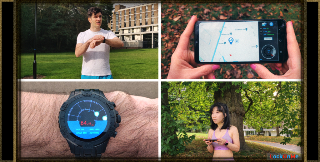
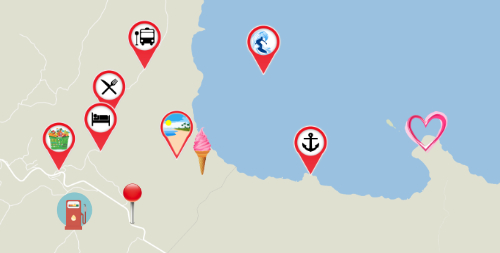
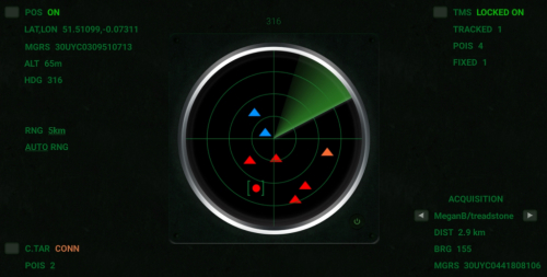
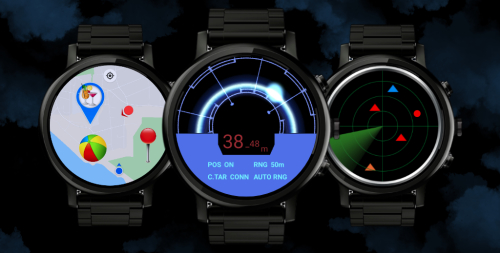
For instance, groups of people or individuals on their own can drop Points of Interest (POIs) on a digital map during the preparation phase of an event (camp site, rally point...), or on the fly in the heat of the action (danger spot, things not to miss...). In the field, they would view their own position relative to these markers on their mobile phone or watch, on a map or a radar screen (the advantage of the radar being that it doesn't require access to the internet to download the map layer).
All of this while having the option of tracking the live positions of their companions, to make sure no one loses track of the flock.
LockOnMe is the go-to app when it comes to creating those POIs, or simply keeping trace of each other's location – be it live or at least pinpointing the last position broadcast.
The latter either for peace of mind, which can't be totally discounted these days, or to seamlessly meet up without the awkward explaining of where you are, especially if that would have involved back and forth messages in the middle of a crowd – or in the middle of nowhere!
And who knows, when running late to a meeting, sharing your live location might provide a token of good faith; the other person may also decide to meet you half way.
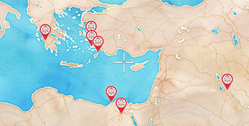
A day in the forest or on the ski slopes, and you could do with having the option to set up gathering points for the morning meetup, lunch or picnic, or to go down that one thrilling piste all together. Treks could be planned in advance with waypoints, and the best spots for particularly gorgeous photographs could be marked that day on the fly. Since POIs defined in LockOnMe can have a note and an image link, they could be used to mark the location of the photos taken, as a souvenir for yourself or to show off your trip to others.
When running in a larger group, like as part of a running club, the coordinator could set up the weekly meeting place as a POI, and then add a few numbered turning points to show the track in advance. On the day, LockOnMe would enable the runners to make sure they don't wander off course; and someone could be put in charge of keeping track of everyone's position during the evolution. Also, why not exchange your target details with the other running mates, so the faster bunnies who are let loose earlier on know how to come back to the laggards (usually me…) later for support and encouragement?
Watch this video to see LockOnMe in action, running on a mobile phone and smartwatch:
My favourite feature has to be the capability to just create a bunch of POIs when you need to. So whenever it comes to adding landmarks for your next trip, or, hop!, marking down where the squirrels secretly buried their nuts(…), LockOnMe can take care of that.
It doesn't force others to have the mobile app to view your position or POIs, since they can follow your target on the Web Tracking Console, like so:
lockon.me/?map=Decimal&track=(MeganB/treadstone)![]()
So next time you are out running, biking, skiing, hiking, meeting people up somewhere new – or just want to arrive to the shop in style by watching the radar screen – have LockOnMe by your side as part of your digital toolkit.
°•◦♠♡♢♣♤♥♦♧●◯